JKR's Infographic Video Explains How The Batang Kali Landslide Happened
The department explained in a statement that the accumulation of underground water triggered the deadly landslide.

By Yap Wan Xiang — 19 Dec 2022, 04:20 PM
The Public Works Department (JKR) has released an animated video to explain how the landslide happened at Batang Kali, Selangor
The 45-second infographic video was uploaded on its TikTok account yesterday, 18 December, before it was shared by other official governmental bodies, such as the National Disaster Management Agency (NADMA), on Facebook.
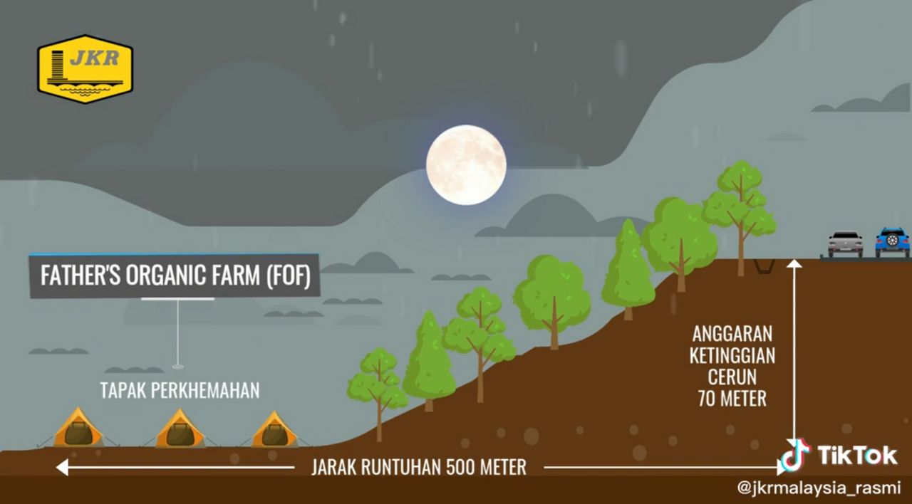
The easy-to-understand video begins by showing the location of the Father's Organic Farm campsites, which were situated beside a forested hillside.
About 6m away above the hill was the road, B66 Seksyen 13.0 Jalan Batang Kali-Genting Highlands.
It is estimated that the slope was 70m tall, and that the landslide affected a stretch that was about 500m long.
According to the video, the first landslide displaced all the camps, with some of them being overrun by mud and trees
About 20 to 30 minutes later, the second wave of landslide took place, engulfing all campsites in the area.
The drainage system by the road was also affected by the landslide.
It is understood that there are no cracks on the tarmac surface of the B66 Jalan Batang Kali-Genting Hulu Selangor
However, The Edge Markets reported Works Minister Datuk Seri Alexandar Nanta Linggi as saying that the road has been closed under the instructions of the Hulu Selangor district police headquarters due to security reasons.
In a statement, JKR explained that high soil saturation and high pore water pressure, due to the accumulation of underground water at the bottom of the slope, weakened the toe of the B66 road slope, before subsequently causing the landslide.
According to a UK site development solutions company, Tensar Corporation, pore water pressure refers to "the pressure of groundwater held between soil or rocks in the gaps (or 'pores') between particles. It is affected by the soil type, water flow conditions, and level of the water table".
The explanation said the metric is important in geotechnical engineering because it influences soil behaviour, including its shear strength.
It is understood that if the soil becomes more saturated, it will cause the pore water pressure to increase, which, in turn, will reduce the shearing resistance of the soil.
