MH370: What You Should Know About China's Mistake Of Releasing Debris Images
The Chinese government has released a steady stream of propaganda-like news and images through its state-controlled media in its search for MH370. Why?

By Sadho Ram — 13 Mar 2014, 11:25 PM — Updated almost 11 years ago
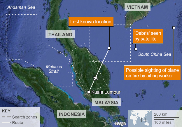
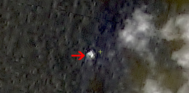
On Wednesday Night, 13 March 2014, China Released Grainy Images Taken From A Chinese Satellite That Showed Possible Debris From The Missing MH370
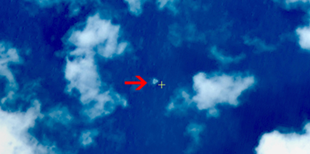
One of the Chinese satellite images
Image via China Center for Resource Satellite Data and ApplicationThe Three Large Floating Objects Sparked New Theories And Sent Ships And Aircraft Scurrying To The Location
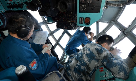
When Malaysia Deployed Their Military Assets In Search Of The Suspected Debris, They Found Nothing
“There is nothing,” Malaysia’s civil aviation chief Azharuddin Abdul Rahman told reporters in Kuala Lumpur after planes were sent to scour the area. “We went there, there is nothing,” he said, deflating the latest tantalizing lead in the six-day hunt.
Almost 24 Hours Later, The Images Were Completely Dismissed By Malaysian Leaders, Saying That The Chinese Embassy Said "The Images Were Released By Mistake"
Hishamuddin Hussein, Malaysia’s defence minister and acting transport minister, said that an aircraft from the country’s coastguard was sent to investigate potential debris shown on Chinese satellite images on Thursday morning. “We deployed our assets but found nothing,” he said.
Adding to days of apparently false leads and U-turns on information, Mr Hishamuddin then read out a statement from the Chinese ambassador to Malaysia saying the satellite images had been released “by accident”.
cnn.comSo, What Really Happened? The Washington Post's William Wan Writes:
Given China's criticism of the Malaysia-led investigation, there was an element of schadenfreude (feeling of joy or pleasure when one sees another fail or suffer misfortune) in the reaction to China's admission of a mistake.
washingtonpost.com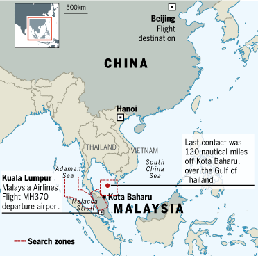
To many, however, it was unclear what the mistake was – whether the photos had been discounted but were released anyway or whether they didn't show the objects they purported to.
washingtonpost.comTrying To Decipher The Meaning, Wan Further Dwells: "Deepening The Mystery Is The Fact That The Images Were Taken Sunday But Not Posted Online Until Late Wednesday"
They were released on the Web site of a relatively unknown Chinese agency called the State Administration for Science, Technology and Industry for National Defense and went unnoticed by many for several hours. Chinese officials have explained neither why the satellite photos were posted so long after they were taken nor their poor quality.
washingtonpost.comWan Suspects That The Motive Behind Releasing The Images May Have Been China's Eagerness To Present A Proactive Image Of Its Search Efforts To Its Citizens
One reason the images may have been published despite lack of confirmation is China's eagerness to present a proactive image of its search efforts to its citizens. Since Sunday, the government has released a steady stream of propaganda-like news and images through its state-controlled media.
washingtonpost.com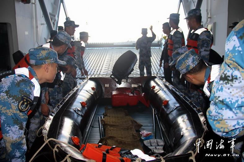
On Wednesday, for example, its military released images of Chinese search ships with a headline saying they had found life jackets and oil drums. After a period of brief excitement online, the defense ministry said the life jackets were determined to have come from a ship rather than an airplane.
washingtonpost.com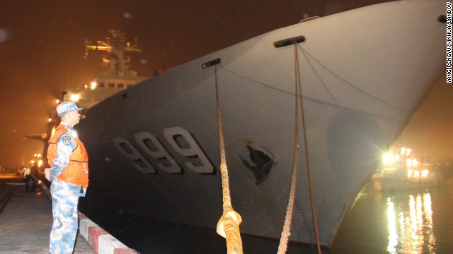
The Chinese navy warship Jinggangshan prepares to leave Zhanjiang Port early on March 9 to assist in search-and-rescue operations for the missing Malaysia Airlines flight. The Jinggangshan, an amphibious landing ship, is loaded with lifesaving equipment, underwater detection devices and supplies of oil, water and food.
Image via turner.comWan, Citing One Chinese Satellite Researcher Of The Government-Affiliated Think Tank, 'Chinese Academy Of Sciences', Further Explains:
China has made itself visible in the search in part in reaction to criticism from its citizens that their government hasn't done enough to protect citizens abroad – and because out of the 239 passengers on board the plane, 154 were from China or Taiwan.
washingtonpost.comAs for the mysterious satellite photos that went bust, one Chinese satellite researcher involved in the effort said it was hard to verify or get more information about the three objects because of the limited number of images available from Chinese satellites.
washingtonpost.comThe three mystery objects were identified on images captured at 11 a.m. March 9, but Chi Tianhe, who works at the government-affiliated think tank Chinese Academy of Sciences, said researchers have not had access to earlier images from that same site.
washingtonpost.com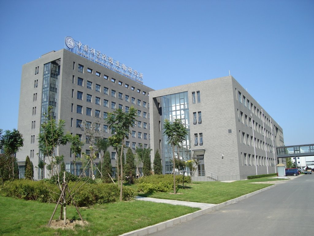
Most Chinese satellites were pointed at the area in question only after the plane vanished, and images are limited to set intervals during which satellites passed over that area, Chi said. Other countries, however, may have captured images of other areas from other times, he said. NASA and the U.S. government in particular, he pointed out, have considerable satellite assets to draw on.
washingtonpost.comCiting Another Researcher Involved In The Chinese Effort, Wan Writes That There Has Been Competition And Pressure Between Two Main Groups Working To Find The First Sign Of Debris
There are two main groups involved in the Chinese effort, he said. The Chinese Academy of Sciences’ Institute of Remote Sensing and Digital Earth, where Chi works, has been helping analyze satellite images.
washingtonpost.comThe photos of the three unknown objects were captured by the second group: the government’s China Center for Resource Satellite Data and Application (CRESDA). Another researcher involved in the effort said there has been competition and pressure between the two group to find the first sign of debris.
washingtonpost.comWan Writes That On Tuesday, A Full Day Before The Satellite Images Were Released, CRESDA Posted A Short Explanation Of Its Work In Support Of The Search
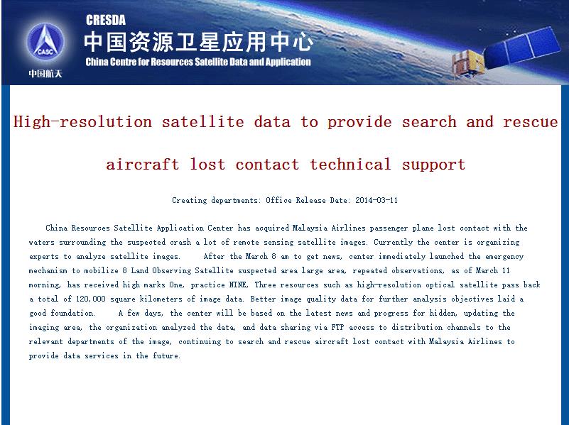
The center said the quality of images it had received so far were “pretty good,” which raises questions about why exactly the photos released Wednesday night were so grainy. China hasn't explained the poor quality of those images, but it could be related to guardedness about revealing the extent of defense capabilities.
washingtonpost.comIn the Tuesday statement, CRESDA said it began tapping eight satellites March 8, the day after the plane disappeared, and had received a large amount of data and images that were being inspected. Those inspections appear to have led to Wednesday night’s release of the satellite images of possible debris at the coordinates 105.63 E, 6.7 N.
washingtonpost.comEven In This Blunder, Many Chinese Remained Defensive
“Why does Malaysia Airlines have to disparage China’s satellite data?” asked one user on the Chinese version of Twitter.
“Press conferences by Malaysia Airlines do only one thing, that is, deny everything,” harrumphed another.
washingtonpost.comOther comments suggest that the satellite blunder wouldn't do much to blunt their week-long criticism of Malaysia’s handling.
“Up until now, it seems that Malaysia has only confirmed one thing: MH370 flight is missing!”
washingtonpost.com