Sabah Is Using These Badass Drones To Fight Malaria
Malaria has met its match thanks to these drones.
By Darian Goh — 28 Oct 2014, 12:56 PM — Updated over 10 years ago
Drones are usually known for surveillance and military purposes. But in Sabah, drones are used to fight something else, malaria.
Drones are usually known for surveillance and military purposes. But in Sabah, drones are used to fight something else, malaria.
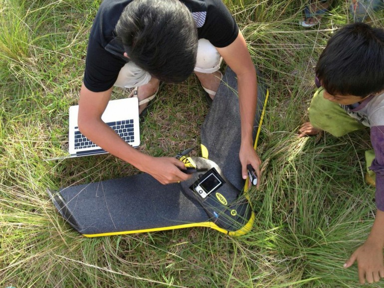
Image via gizmag.comIn a remote area of Southeast Asia, drones are fighting a battle — not against terrorists or insurgents, but against infectious disease.
 mashable.com
Over the last ten years, a new type of malaria has been on the rise in the forests of Southeast Asia, and experts are turning to new technologies to try and figure out why. By using drones to observe the environment from above, researchers are gaining a new perspective on how changes to the terrain may be impacting local wildlife and causing the spread of the disease.
 gizmag.com
Malaria has been on the rise for the past ten years. Previously, it has only spread to humans working in the forests but there are reports that the disease has infected people outside the forest.
Malaria has been on the rise for the past ten years. Previously, it has only spread to humans working in the forests but there are reports that the disease has infected people outside the forest.
Image via twimg.comIn Sabah, Malaysia, human cases of this kind of malaria didn't surface until about 10 years ago, says infectious disease specialist Kimberly Fornace of the London School of Hygiene and Tropical Medicine. She is leading the drone study.
npr.orgIn the past, it was fairly easy to track the spread of P. knowlesi to humans, Drakeley said. The disease tended to show up only in adult men who had spent time in the forest, where they were working on logging operations. The thinking was that mosquitos that had previously fed on macaques infected with P. knowlesi were biting these men, causing malaria.
 livescience.com
Recently, the disease has been affecting children, as well as whole families or other clusters of individuals, the researchers said. In other words, P.knowlesi is now infecting people who haven't been spending time in the forest.
livescience.com
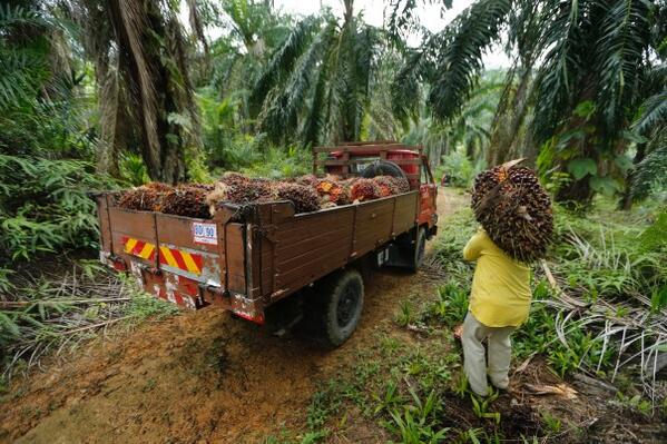
One of the causes why malaria cases are rising is due to deforestation, creating more opportunities for the disease to spread
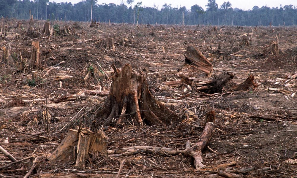
One of the causes why malaria cases are rising is due to deforestation, creating more opportunities for the disease to spread
Image via worldwildlife.orgThe malaria drone mission, described in a study published Oct. 22 in Trends in Parasitology, began in December 2013, when UK scientists decided to track a rare strain of the mosquito-borne disease that has surged near Southeast Asian cities. Understanding deforestation may be the key in seeing how this kind of malaria, known as Plasmodium knowlesi, is transmitted.
npr.orgThe mosquitoes that carry P. knowlesi are forest dwellers. The insects breed in cool pools of water under the forest canopy and sap blood from macaque monkeys that harbor the malaria parasite.
npr.orgFor example, the drone footage has helped the researchers confirm that cornfields aren't just popular with the farmers who tend them; they're also havens for corn-stealing macaques, Drakeley said. The researchers have also noted the clearing of what they call "secondary forests" to make way for other small-scale farming operations, such as the planting of oil palms.
livescience.com
"Secondary forests" are made up of trees that macaques use as paths to get from one point to another, Drakeley said. Cutting down these trees — even only a few of them — means the monkeys may have to move closer to people's homes or other settlements to get where they're going.
livescience.com
So, to understand this better, drones are used to map out the area where the disease spreads, especially where the macaque monkeys move. This is because they are they are the primary carriers of the disease.
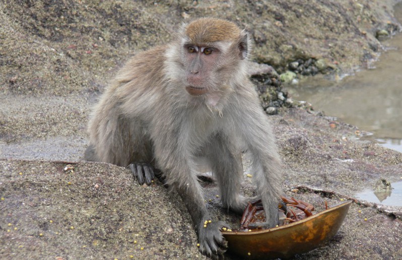
So, to understand this better, drones are used to map out the area where the disease spreads, especially where the macaque monkeys move. This is because they are they are the primary carriers of the disease.
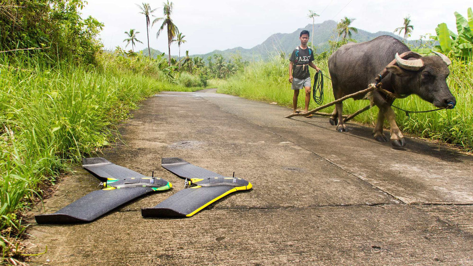
Image via borneoadventure.comResearchers on the island of Borneo are using flying robots to map out areas affected by a type of malaria parasite (Plasmodium knowlesi), which most commonly infects macaque monkeys. In recent years, public health officials in the Malaysian state of Sabah have seen a rise in the number of cases of humans infected with this deadly parasite, which is spread, via mosquitos, from macaques to people.
mashable.com
Plasmodium knowlesi is a malaria parasite that has traditionally affected only long-tailed and pig-tailed macaques in the region. But in the last decade, reports have emerged of humans becoming infected while traveling through the rainforests of Southeast Asia. The disease requires immediate diagnosis and treatment, with severe cases having resulted in organ failure and death.
gizmag.com
By mapping the communities where these cases occur, researchers hope to figure out why the parasite is spreading from monkeys to people with greater frequency, said Chris Drakeley, a professor of infection and immunity at the London School of Hygiene and Tropical Medicine in the United Kingdom, and one of the researchers involved in the project.
yahoo.comThe monkeys are tagged with GPS collars, so that researchers can pinpoint where humans and the macaques are most likely to interact

The monkeys are tagged with GPS collars, so that researchers can pinpoint where humans and the macaques are most likely to interact
Image via npr.org"What we're doing is creating a detailed map, which we can then superimpose or overlay with the human and the macaque movement," Drakeley told Live Science. The movement patterns of both monkeys and humans were derived from GPS data. Locals were asked to carry around GPS tracking devices, while certain macaques were fitted with GPS collars.
mashable.com
The hope is that this GPS data will help the researchers pinpoint where humans and macaques are most likely to interact, and the drones will show the researchers what these areas look like and help them figure out why both species might be drawn to those areas.
yahoo.com
The drones can also be used to monitor likely breeding grounds for mosquitos, which are carriers of the disease. Pinpointing where these insects breed around settlements could help researchers determine how P. knowlesi is spreading.
livescience.com
Previously, locals have been relying on satellite imagery which wasn't as accurate as clouds often blocked the view

Previously, locals have been relying on satellite imagery which wasn't as accurate as clouds often block the view
Image via thejakartapost.comDrones provide a better surveillance picture than satellite images, which are the current standard for mapping environmental changes. But Google Earth images, for example, are only updated every few weeks or months, says parasitologist Chris Drakeley of the London School of Hygiene and Tropical Medicine, who coauthored the Trends in Parasitology study with Fornace. Drones, he says, can provide a more comprehensive, continuous picture: "We avoid cloud cover and can see what the land use was like today, next week and the week after."
npr.orgThe researchers in Malaysia did consider using satellite imagery to map the local landscape, but the clouds that often hang over the island of Borneo make satellite images less useful, Drakeley said. Drones also enabled the researchers to map subtle changes in the landscape on a consistent basis, Drakeley said. This is important for keeping maps up-to-date and for tracking any changes in land use.
livescience.com
Deforestation and land-use change are one of the biggest drivers for infections and is known as one of the causes for the spread of Ebola in humans

Deforestation and land-use change are one of the biggest drivers for infections and is known as one of the causes for the spread of Ebola in humans.
Image via huffpost.com"There's no question that land-use change is one of the major drivers of emerging infections," Morse said. Clearing land for farming and venturing further into forested land, he said, are known causes for the start of deadly outbreaks of diseases, such as Ebola, in humans.
livescience.com
"Poverty drives people to expand their range of activities to stay alive, plunging deeper into the forest to expand the geographic as well as species range of hunted game, and to find wood to make charcoal and deeper into mines to extract minerals," Bausch said. This increases people's risk of exposure to Ebola virus in remote corners of the forest, he added.
livescience.com