[PHOTOS] Satellite Images Show Us Full Span Of MH17 Crash Site
The US Airbus Defence & Space and AllSource Analysis has released satellite images of the MH17 crash site that was taken three days after the crash.
By Mei Mei Chu — 23 Jul 2014, 12:34 PM — Updated over 10 years ago
The US government released this satellite trajectory map of flight MH17 path and the site from which the missile was launched

The US government released this satellite trajectory map of flight MH17 path and the site from which the missile was launched
Image via twimg.comThis satellite image of the primary crash site in the rebel-held town of Torez shows where the Boeing 777 engines were found
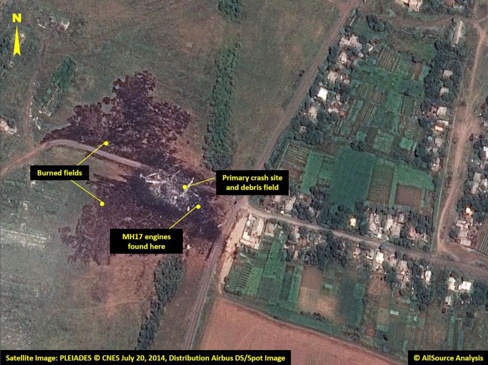
This satellite image of the primary crash site in the rebel-held town of Torez shows where the Boeing 777 engines were found
Image via AllSource AnalysisThe crash left a visibly large burned section in a field between the Ukrainian towns of Grabove and Rasypnoye
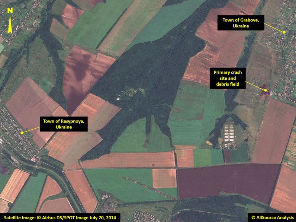
The crash left a visibly large burned section in a field between the Ukrainian towns of Grabove and Rasypnoye
Image via AllSource Analysis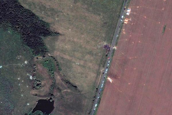
Wreckage and debris are scattered across the field and between buildings
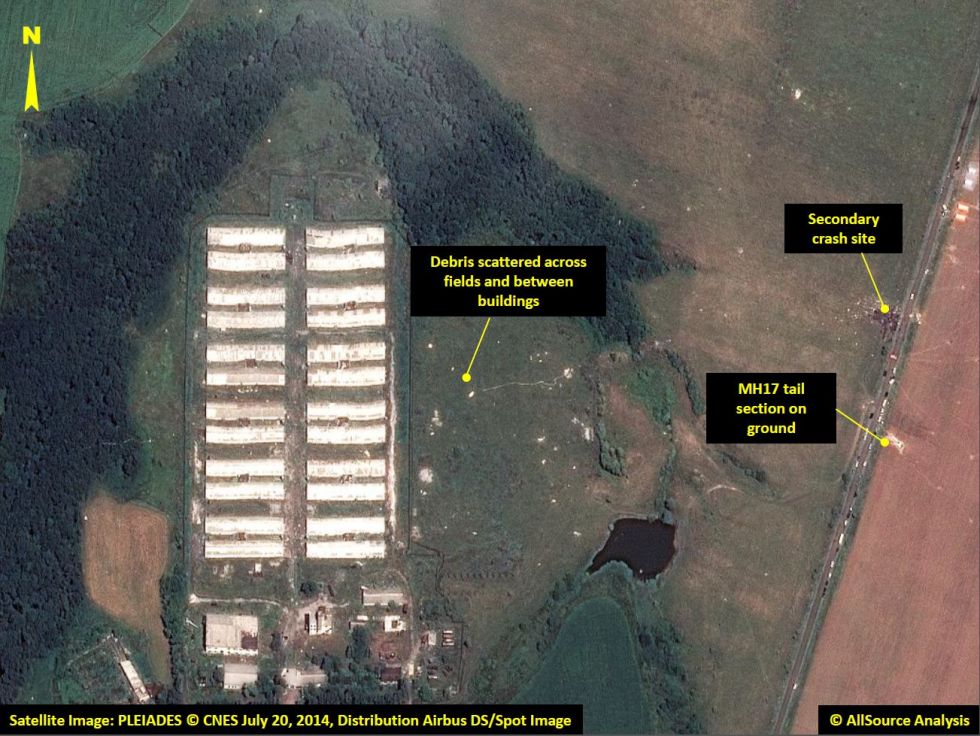
Wreckage and debris are scattered across the field and between buildings
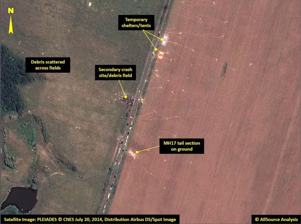
Image via AllSource AnalysisDebris can be found across fields as far as 3.2 kilometres away from the primary crash site
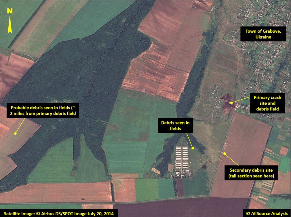
Debris can be found across fields as far as 3.2 kilometres away from the primary crash site
Image via AllSource Analysis
Debris can be found across fields as far as 3.2 kilometres away from the primary crash site
Image via AllSource AnalysisThe remains of the victims were stored in refrigerated train cars before being sent to the Netherlands
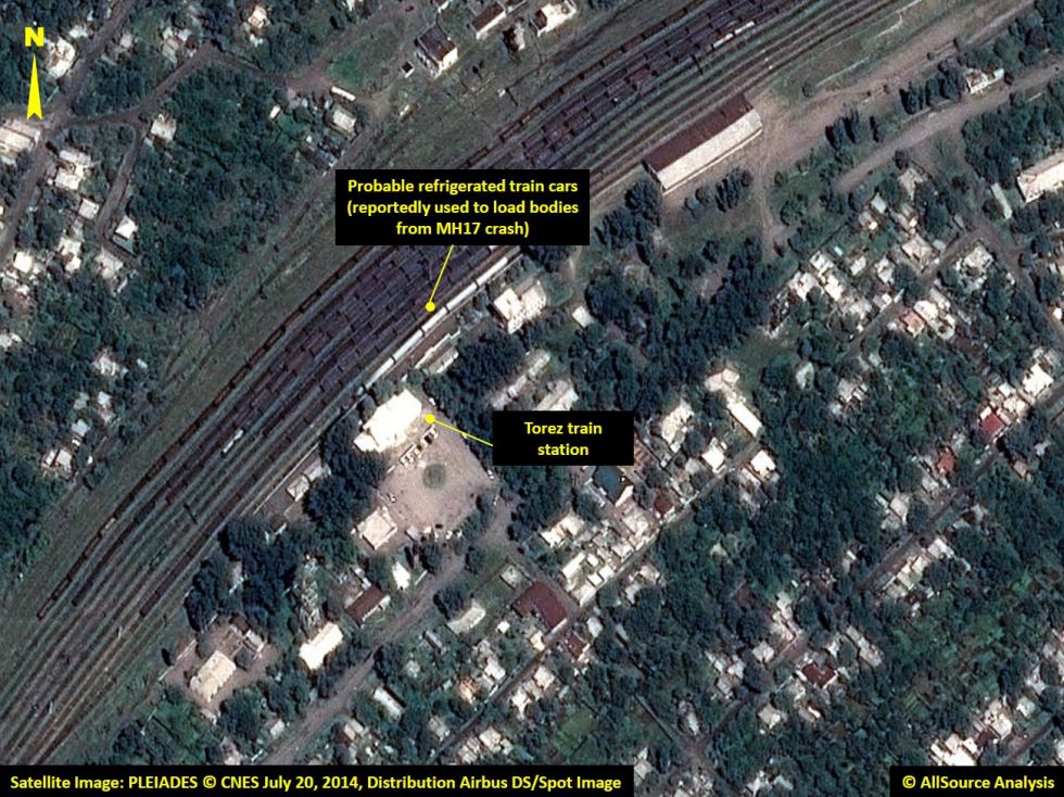
The remains of the victims were stored in refrigerated train cars before being sent to the Netherlands
Image via todayonline.com