Here's How Google Earth Is Helping Wildlife Biologists Save Borneo's Sun Bears
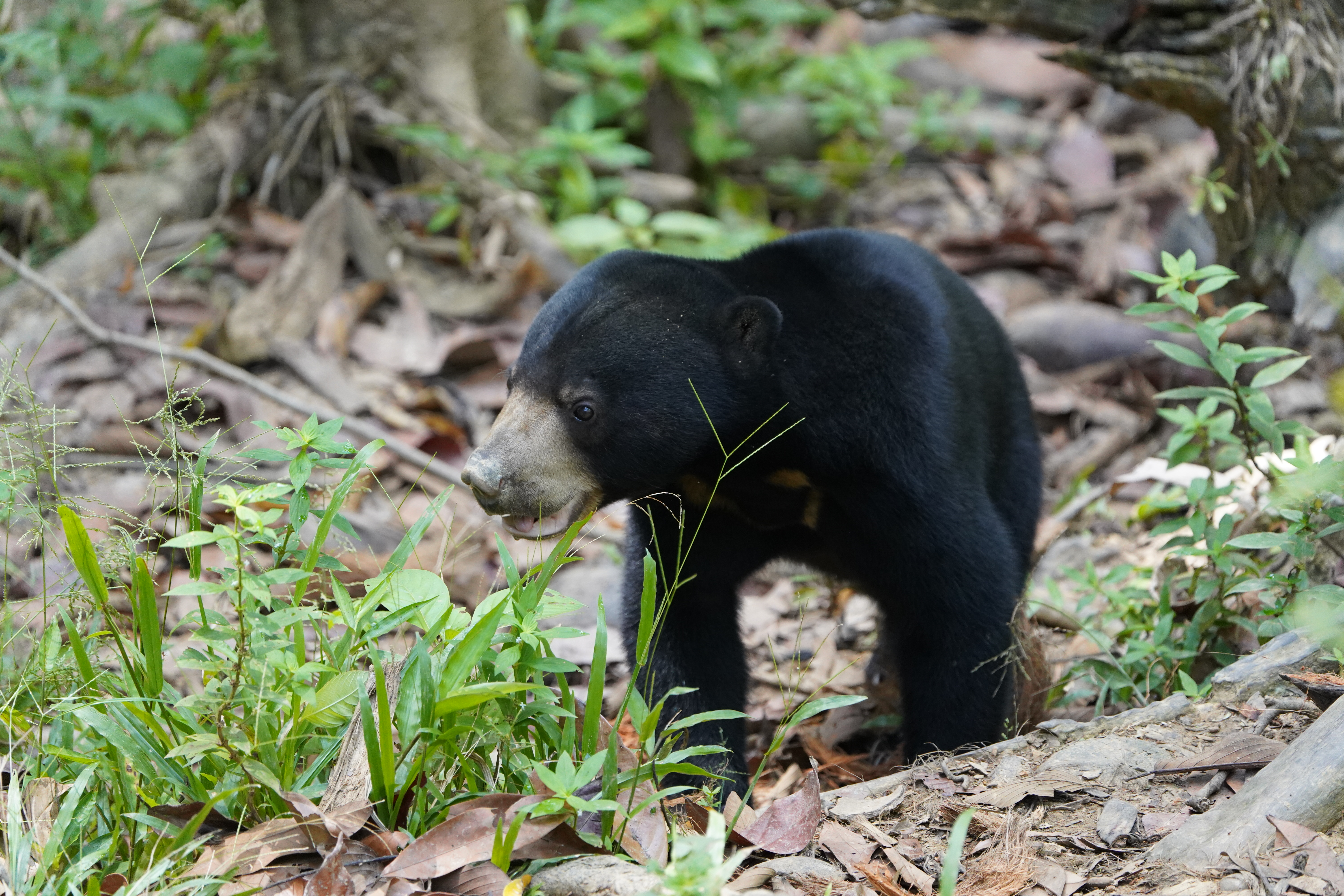
The world's smallest bear spends much of its life high in the trees, making sightings rare.

By Sukhbir Cheema — 05 Mar 2025, 02:30 PM
There are an estimated 10,000 sun bears around the world, and tracking them in the dense rainforests of Borneo is no easy task
The world's smallest bear, which can only be found in Southeast Asia, spends much of its life high in the trees, making sightings rare.
But for wildlife biologist Wong Siew Te, understanding their movements is crucial to protecting them from habitat loss and poaching.
"Even after my 26 years of being involved, there is still much to learn about sun bears," Wong said.
"Their habitat is extremely dense forest that is a very challenging work environment for researchers, which is why so little is known about them."
That's where Google Earth comes into the picture.
Using high-resolution satellite imagery and mapping tools, Wong and his team at the Bornean Sun Bear Conservation Centre (BSBCC) can monitor the forests of Sabah, Malaysia, identifying changes in land use and key areas for conservation
By overlaying Google Earth's maps with data from GPS collars and remote camera traps, researchers can track sun bear movement patterns, pinpoint their home ranges, and even predict how they respond to encroachment.
This helps the team avoid wild bears during rehabilitation walks, place cameras in the most strategic locations, and plan low-impact routes through the jungle.
"This is all essential information for studying the ecology of the bears — it all begins with the map," Wong said.
Wong explained that as a biologist, and as a forest ecologist, he knows how delicate ecosystems can be, and how interconnected the elements are.
"What happens with one species will likely affect others. And this is ultimately why preserving the sun bears is so important."
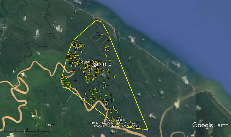
Wong and his team are using camera trap data, combined with Google Earth's mapping capabilities, to estimate the sun bear's population density — an essential step in measuring conservation progress
"Sometimes we have to go way beyond the reach of roads, trekking the forest and even hiring local villagers to take us on waterways in their boats," Wong revealed.
Thanks to Google Earth, his team now has the tools to do conserve Borneo's sun bears.
"Google Earth maps help us find the best, safest, least-impactful routes to sites we need to visit in the forest," Wong said.
