Super Typhoon Inday Passes By The Philippines. Here’s How It Will Affect Malaysia
Its immense atmospheric draw is significantly intensifying the southwest monsoon across the South China Sea.


 Cover image via
 Follow us on Instagram, TikTok, and WhatsApp for the latest stories and breaking news.
Super Typhoon Inday, or internationally known as Super Typhoon Bavi, weakened into a standard typhoon early Thursday, 9 July, as it charted a path across the Philippine Sea
The Philippine Atmospheric, Geophysical, and Astronomical Services Administration (PAGASA) said the system continues to pack maximum sustained winds of 175km/h, with gustiness reaching up to 215km/h.
As of 4am, forecasters tracked the storm centre approximately 925km east of Northern Luzon, moving west-northwestward at a speed of 20km/h, according to ABS-CBN.
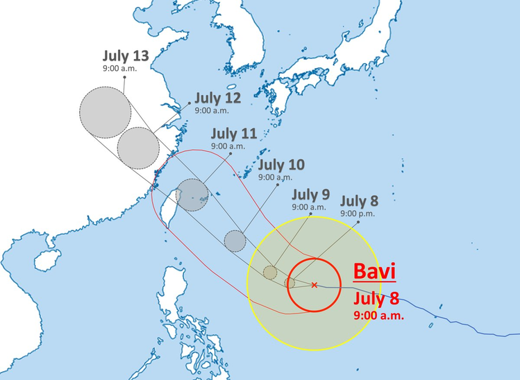
The authorities do not expect the typhoon to make direct landfall over the main Philippine landmass
However, the system will pass extremely close to the northern island province of Batanes on Friday, 10 July, before exiting the regional boundary on Saturday, 11 July.
Tropical cyclone warnings remain active across 12 northern and eastern provinces, including Isabela, Cagayan, and Ilocos Norte.
Several local government units suspended school classes on Thursday as gusty winds and heavy rainfall disrupted daily routines across Catanduanes, Aurora, and the Cordillera region.
Concurrently, the typhoon has significantly intensified the regional southwest monsoon, unleashing severe rainfall across the Zamboanga Peninsula, MIMAROPA, and Western Visayas, where disaster management agencies warned of rain-induced landslides and severe flash floods.
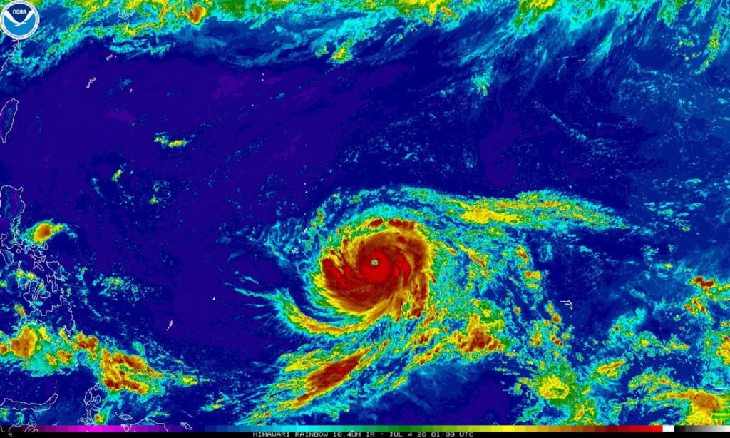
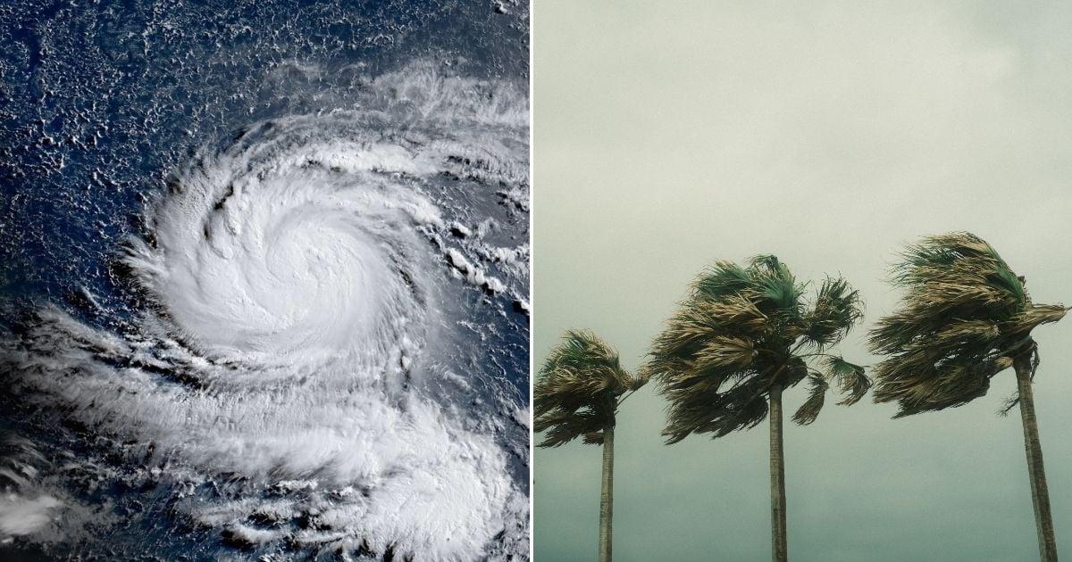
Satellite imagery of Super Typhoon Bavi as it develops in the Western Pacific Ocean area.
Image via New Straits TimesHow will this affect Malaysia?
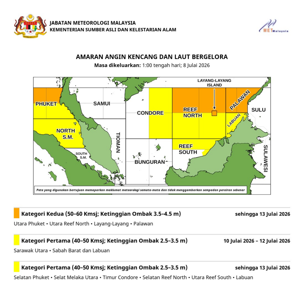
While Typhoon Inday poses no direct risk of making landfall in Malaysia, its immense atmospheric draw is significantly intensifying the southwest monsoon across the South China Sea.
This regional meteorological dynamic is pulling moist air streams across Southeast Asia, triggering heightened weather advisories from the Malaysian Meteorological Department (METMalaysia).
The enhanced monsoon flow is causing widespread afternoon thunderstorms, heavy downpours, and sudden gusty winds across northern Peninsular states — including Perlis, Kedah, Penang, and Perak — alongside coastal sectors of western Sabah, Sarawak, and Labuan.
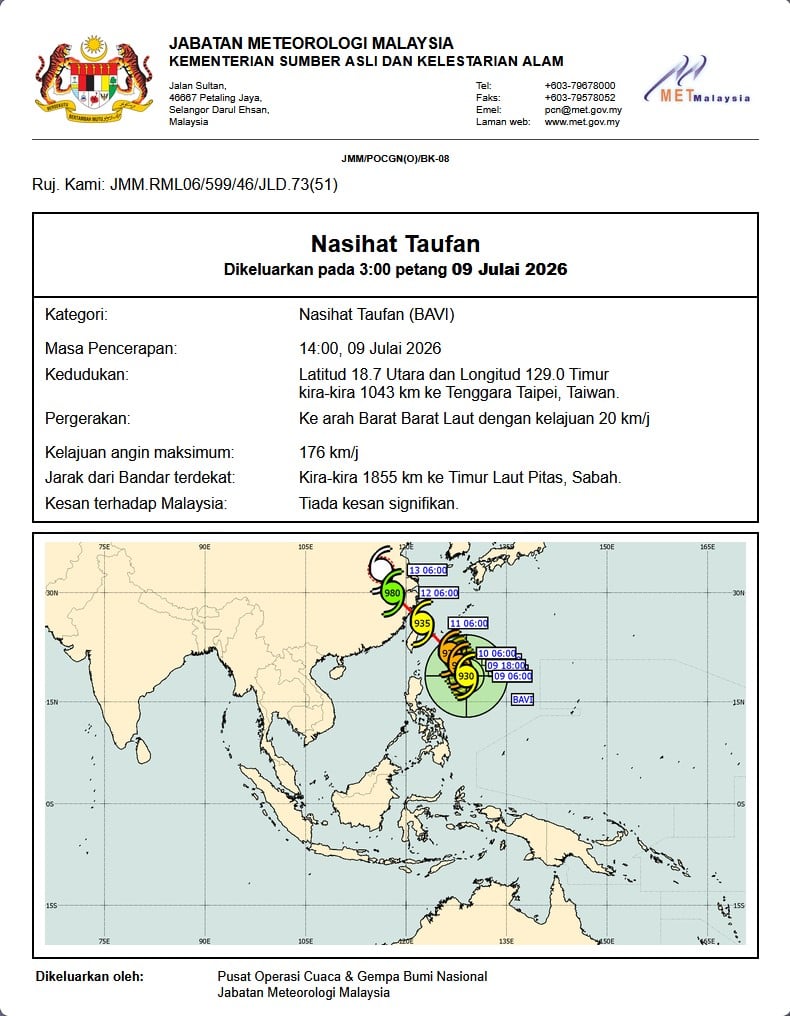
The primary hazard for Malaysia lies in maritime conditions, as strong south-westerly winds measuring between 40 to 50km/h churn up the surrounding seas
METMalaysia warned that wave heights could reach up to 3.5 metres across the Northern Straits of Malacca, the eastern South China Sea, and waters off Labuan and western Sabah.
These turbulent conditions present severe dangers to small craft, fishing operations, offshore workers, and ocean recreation. Coastal communities in Sabah and northern Peninsular Malaysia are urged to remain vigilant against localised squalls, while ferry operators and maritime transport services must monitor official weather bulletins closely as rough seas persist through the weekend.